
Revision Point Survey (series)
By Paul R Jones
2021
Dimensions
20 x 20
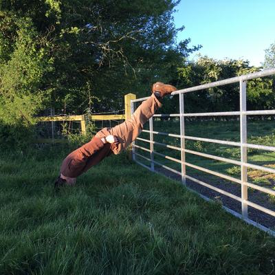
Based on the revision point from the Ordinance Survey which, during the 1940s included a series of photographs of selected points within the environment. This data was used to make cross referencing new mapping easier. Revision points where sited at small, static features in the built environment. These carefully considered points acted as anchor in order to construct an accurate map of the urban developments. In this project I reenact the procedures of such activities but with a focus on borders and the unspecific, bringing into focus the ordinary or unnoticed.
The recording of the revision points was often quite physically demanding. Their equipment included a tripod, camera, and large wooden black board on to which the co-ordinates would be recorded. Often the surveyor would have to carry all the equipment to record the point across to different points in the city.

Paul R Jones

Paul R Jones

Paul R Jones


Join Axis
We support artists
Funding, visibility, connection and practical help.
Membership includes £15 million of Public Liability Insurance!