Chart of Invisibility
By Amanda Wallwork
2017
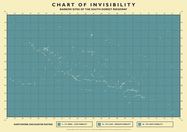
The Chart of Invisibility – graphic poster
Inspired by an archive 1940’s copy of ‘Phillip’s Chart of the Stars’ The Chart of Invisibility uses archaeological data on the distribution and current condition of round barrows and re-imagines it as a constellation map. The map charts the position of all known barrows across the whole South Dorset Ridgeway area. The varying size of the dots or ‘earthwork encounter rating’ indicates whether a barrow is in good condition and therefore visible; damaged and partially visible or completely destroyed with no visible trace remaining. Eliminating all other mapping detail brings the focus purely on the pattern of distribution and relationship to landscape – the ridge of higher ground showing clearly in the alignments.


Join Axis
We support artists
Funding, visibility, connection and practical help.
Membership includes £15 million of Public Liability Insurance!